“Google choose the fastest route to home.” Today, drivers are better informed about routes and traffic than ever before. Using 'mapping apps', drivers can see traffic before their drive in realtime.
But what happens when these virtual streets are shaded in dark red, warning drivers of a traffic nightmare? Here's how an artist wheeled around 99 smartphones in a cart to create a virtual traffic jam.
How mapping apps work
Due the usage of the mapping apps mentioned above, drivers can select different routing styles, for example the fastest, the shortest and the ecological option. In today's society the fastest routing style is preferred the most and in some mapping apps even set as default option.
These apps detect traffic jams and calculate routing options to your destination. Google Maps is able to do this because the app uses your real-time location data, which it anonymously sends back to Google. The company uses this information to calculate how many cars are on the road and how fast these cars are moving. When it detects a traffic jam, the app will suggest an alternative route.
Due the alternative routes, residents of small neighborhoods complained about increased traffic. Cars end up jamming roads in residential areas and school zones. Endangering children who used to play in these calm streets. As result, these apps even seem to influence housing markets.
So, if mapping apps have such power to change the visually aspect of our surroundings, like housing, can’t we take the power back?
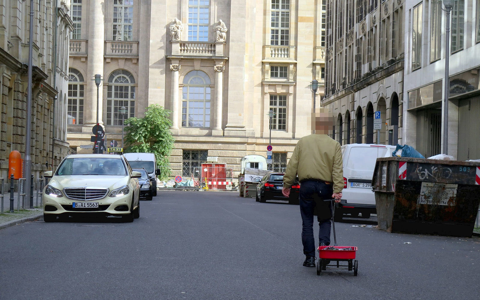
How an artists caused a virtual traffic jam
Artist Simon Weckert showed the power of the usage of Google Maps with his performance and installation Google Maps Hacks. Walking with a handcart filled with 99 smartphones through a city.
Questioning the power of mapping apps and the power we as humans have over them. Walking on empty roads Weckert and his 99 smartphones, all running the mapping app Google Maps, generated a ‘virtual traffic jam’.
Resulting in green streets turning red in the mapping app (Madrigal, 2018).Just like people use running apps to draw figures on virtual maps, and like Israeli airline El Al drew the outline of a boeing 474 to pay tribute to its last flight (Martin, 2019), Weckert shows how we can use the power of the mapping apps itself to change the visual aspect of the app itself.
It shows how our world and the virtual world are intertwining with each other, or, how simulations become more meaningful than the reality they represent.
Share your thoughts and join the technology debate!
Be the first to comment